You are filling in a form, sending a parcel to a home off Al-A'sha Street, or meeting someone at Manfouhah metro station, and you need the Al Manfuha postal code right now. Here it is: 12587. New Manfuha streets use nearby codes, so your street decides which code is yours.
Al Manfuha is one of the oldest neighbourhoods in Riyadh, a historic village in the south of the city that the modern capital grew around (also spelled Manfouhah on some listings). This page gives you the code for your street, the nearby building codes, and a way to check your exact building code, all for Al Manfuha only.
What Is the Al Manfuha Postal Code?
The Al Manfuha postal code is 12587. The number breaks down as 1 for the Riyadh region, 25 for the southern sector, and 87 for the Manfuha zone. It is also called the ZIP code, the term international websites use for the same five digit number.
The code 12587 is the one guides list for Manfouhah Al Jadidah, the New Manfuha area. Its residents use 12587 on forms, deliveries, and registrations every day. If you are sending a parcel to a home in New Manfuha, visiting the Al-Abeer Medical Complex, or registering an address in the old village streets, 12587 is the code you start with, and the table below gives you the code for your street.
Al Manfuha Postal Codes by Street and Building
| Code | Street / Area | Note |
|---|---|---|
| 12587 | Manfouhah Al Jadidah (New Manfuha), Al-A'sha Street area | Main district code. Use this for most Manfuha addresses. |
| 12653 | Al Fryan Street, New Al-Manfuha | Building code (Al-Abeer Medical Complex 3). Check your building. |
If your building is not on this table, use 12587 for the district and check your exact building code on the SPL National Address map. The short check is in the How to Find section below.
Why Different Websites Show Different Al Manfuha Codes
Two things confuse this district. First, the code 12653 appears on business listings in New Manfuha, and some readers take it for the district code. It is real, but it is the building code for Al-Abeer Medical Complex 3 on Al Fryan Street, not the code for the whole district. Second, Manfuha has two parts with similar names: the old village and New Manfuha (Manfouhah Al Jadidah). Guides list 12587 for New Manfuha, and older streets in the village can carry other 126 codes, so always check your street.
Use 12587 for the district. Use the table above for your street. Use the SPL map for your exact building.
Where Is Al Manfuha?
Al Manfuha sits in southern Riyadh, north of Al Masani and south of Skirina, in the Batha sub-municipality, in the southern part of the 12 zone. It is about 30 minutes from King Khalid International Airport by car. Al-A'sha Street, a wide avenue named after the poet Al-A'sha, cuts through the centre of the district.
The district sits next to Batha postal code to the north, and the Blue Line runs through it. Its position on the old southern road into Riyadh is why it holds some of the city's oldest streets, and why the code 12587 appears on addresses across south Riyadh. Al Aziziyah lies about 4.5 kilometres east of Manfuha, and the Al Aziziyah postal code is 14512 for that southern district.
Many people in Riyadh still give directions by landmark instead of a code. They say “near the old Manfuha tower” or “by Al Manfouha Garden” rather than 12587. That works for a taxi driver, because drivers know the old landmarks. It does not work for a delivery or an official form, because a landmark covers a whole area and the code points to your street. Give both together: “Al-A'sha Street, near the old Manfuha tower, 12587”.
Famous Landmarks in Al Manfuha
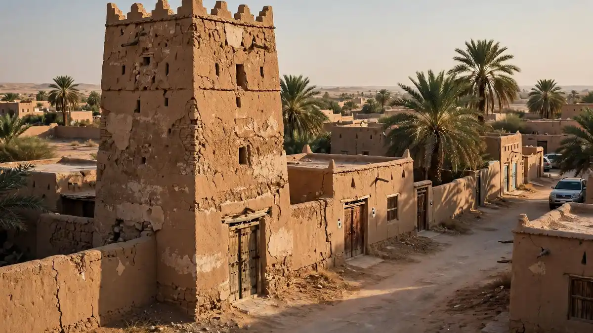
Manfuha historic tower: an ancient observation tower, one of the old mud-brick buildings that remain from the days when Manfuha was a village.
Al Manfouha Garden: a neighbourhood park with a football field, a children's playground, a walking track, and palm trees.
Al-A'sha Street: the wide avenue through the centre of the district, named after the poet Al-A'sha, the district's most famous son.
Manfouhah metro station: a Blue Line station in the district, between Skirinah and Al Iman Hospital stations.
Al-Abeer Medical Complex 3: a clinic complex on Al Fryan Street in New Manfuha, in the 12653 area.
Old mud-brick buildings: some of the town's old mud-brick buildings remain from the days when Manfuha was a twin village to walled Riyadh, on the edge of Wadi Hanifa.
Living in Al Manfuha
Al Manfuha is one of the poorer districts of Riyadh today, and most of its original inhabitants have moved to newer districts. The old village streets sit beside newer blocks in New Manfuha, and the district keeps a strong local character that newer suburbs do not have. Most people who look up this code are sending a parcel to a home here or visiting family.
Transport and Getting Around
Manfouhah station on the Blue Line serves the district, between Skirinah and Al Iman Hospital stations, with bus links including the Manfuha 19 rapid bus line. Al-A'sha Street and the roads north to Batha carry most local traffic. Change at Qasr Al Hokm for the Orange Line to Al Malaz postal code. King Khalid International Airport is about 30 minutes away by car. The Blue Line continues north from Manfouhah through central Riyadh, serving Al Murabba station, Passport Department station and Ministry of Finance station, and the Al Murabba postal code is 12613 for that central district. The King Khalid International Airport postal code is 13458 for the airport itself.
Schools and Hospitals
Schools and clinics serve the local streets, and the Al-Abeer Medical Complex on Al Fryan Street is the best known clinic in New Manfuha. Al Iman General Hospital is one metro stop south of Manfouhah station. Supermarkets and small shops line Al-A'sha Street and the streets around the garden.
How to Find Your Exact Al Manfuha Postal Code
The table above gives you the district code. Your exact building code comes only from the official SPL National Address map. Open the map, search your building in Al Manfuha, and the map shows the exact code. The fastest check is the green plate on your building, which carries the full address. For a delivery, give the driver the code and the nearest landmark, and share your GPS location as well. The full steps are on the homepage, in the How to Find Your Exact Postal Code section.
How to Write an Al Manfuha Address
Here is one example for a home delivery in Al Manfuha:
Home delivery address, Al Manfuha
Building No. 6643, Al-A'sha Street, Al Manfuha District,Riyadh 12587-6643, Saudi Arabia
Use the district code 12587 with your building number after a dash. The full address format is on the homepage.
Frequently Asked Questions
What is the postal code of Al Manfuha, Riyadh?
Is the Al Manfuha postal code 12587 or 12653?
What is the ZIP code for Al Manfuha?
What is the postal code for Manfouhah metro station?
How do I find my exact building code in Al Manfuha?
Does Al Manfuha have one postal code or several?
Explore Other Riyadh District Postal Codes
Looking for another district? The full list of all 34 Riyadh districts is on the homepage. Neighbouring district pages (Batha, Al Malaz, Al Naseem) are linked below.
Conclusion
The Al Manfuha postal code is 12587. Some buildings in New Manfuha use 12653, so use the table above for your street, and check your exact building code on the SPL National Address map. For the full Riyadh list and the how-to steps, see the homepage.
Sources
- SPL National Address map (maps.splonline.com.sa): official lookup for the exact building code.
- guidetoksa.com/postal-codes-for-saudi-arabian-cities/: Manfouhah Al Jadidah 12587.
- saudiscoop.com/tech/postal-codes-of-all-major-cities-in-saudi-arabia/: Manfouhah Al Jadidah 12587.
- sehaguide.com (Al-Abeer Medical Complex 3): 7542 Al Fryan, New Al-Manfuha, Riyadh 12653.
- en.wikipedia.org/wiki/Manfuhah: ancient village and historic neighbourhood in southern Riyadh, north of Al Masani and south of Skirina, in the al-Bat'ha sub-municipality; twin village to walled Riyadh; poet Al-A'sha; old mud-brick buildings and an ancient observation tower remain; Al-A'sha Street cuts through the centre.
- en.wikipedia.org/wiki/Line_1_(Riyadh_Metro): Manfouhah station on the Blue Line, between Skirinah and Al Iman Hospital, with the Manfuha 19 rapid bus line.
- Facebook and Instagram walkthroughs of Al Manfouha Garden: park with a football field, children's playground, walking track, and palm trees.
- mdpi.com/2220-9964/14/5/199 (2025 study, 295 households): only 15.6% rely on the street addressing system for navigation; 81.4% share GPS locations instead.